Chełmiec, one of the summits of the Korona Gór Polski (Crown of Polish Mountains), is a 20-minute drive from us – and if you are fit, you can walk there from our front door. Below are nine summits within an hour's drive: seven with a lookout tower, one with a wooden viewing platform and one crowned by the highest-lying castle ruins in Poland. For each you will find what our guests ask us about – how to get there, where to park, how long the walk takes, whether you can climb the tower at any time – and the story that goes with it.
Nearest summit from the house
Chełmiec, 850 m – about 20 min by car, on foot via Szczawno-Zdrój about 3 hours
Trails from the house
the black trail Wałbrzych Centrum – Szczawienko ends 1.8 km from the house; 4.4 km to the pump room in Szczawno-Zdrój, from there the black or the blue trail up Chełmiec
By car
Borowa and Chełmiec about 20 min, Dzikowiec about 25 min, Wielka Sowa about 37 min, Włodzicka Góra about 39 min, Kalenica about 45 min, Nowa Ruda about 55 min
With children
shortest climbs: Gomólnik Mały (about 40 min) and Włodzicka Góra (45 min); towers with a ramp instead of stairs: Dzikowiec and Wzgórze Gedymina in Szczawno-Zdrój (the town recommends the latter to families with pushchairs too)
Guided walks
free, mostly on Sundays: Sudeckie 9sił to all nine summits (spring and autumn) and LOT Aglomeracji Wałbrzyskiej around the towns of the region
Nine summits: seven towers, a platform and castle ruins
Range by range: from the Góry Wałbrzyskie and Góry Kamienne through the Góry Sowie and Wzgórza Włodzickie to the Góry Suche. Driving times are measured from our gate; walking times follow the hiking map – one way, uphill.
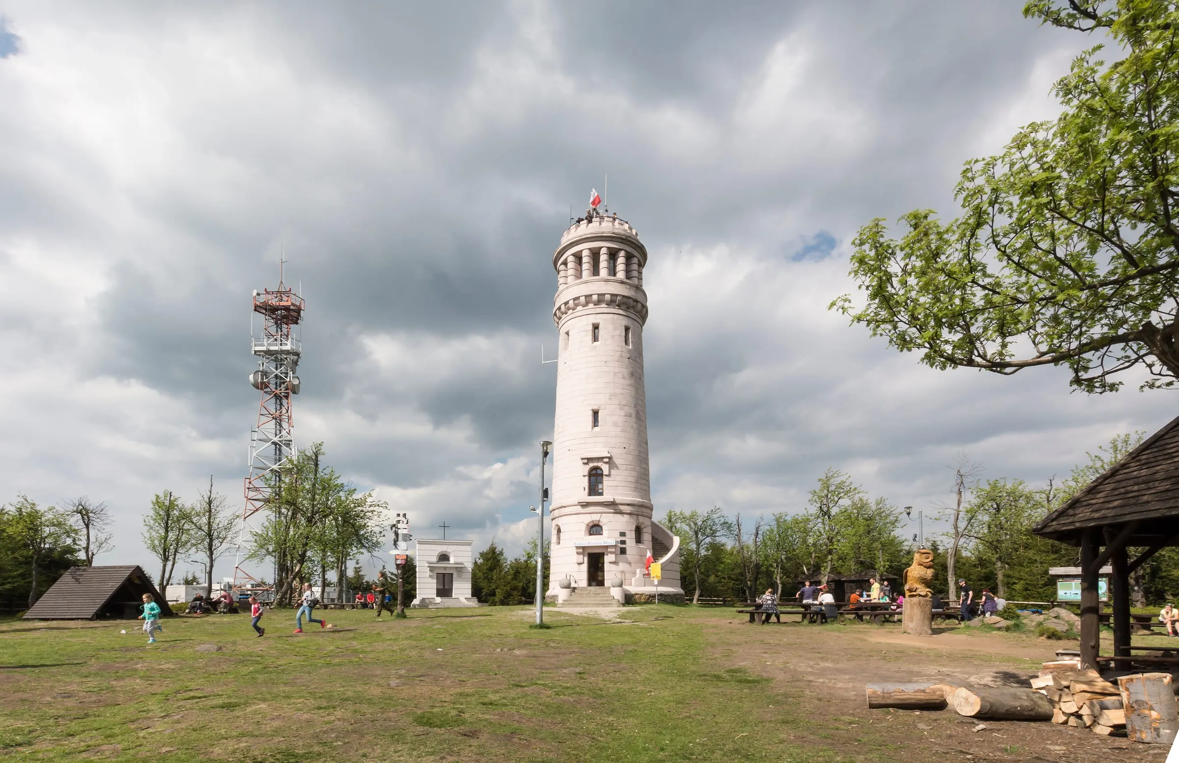
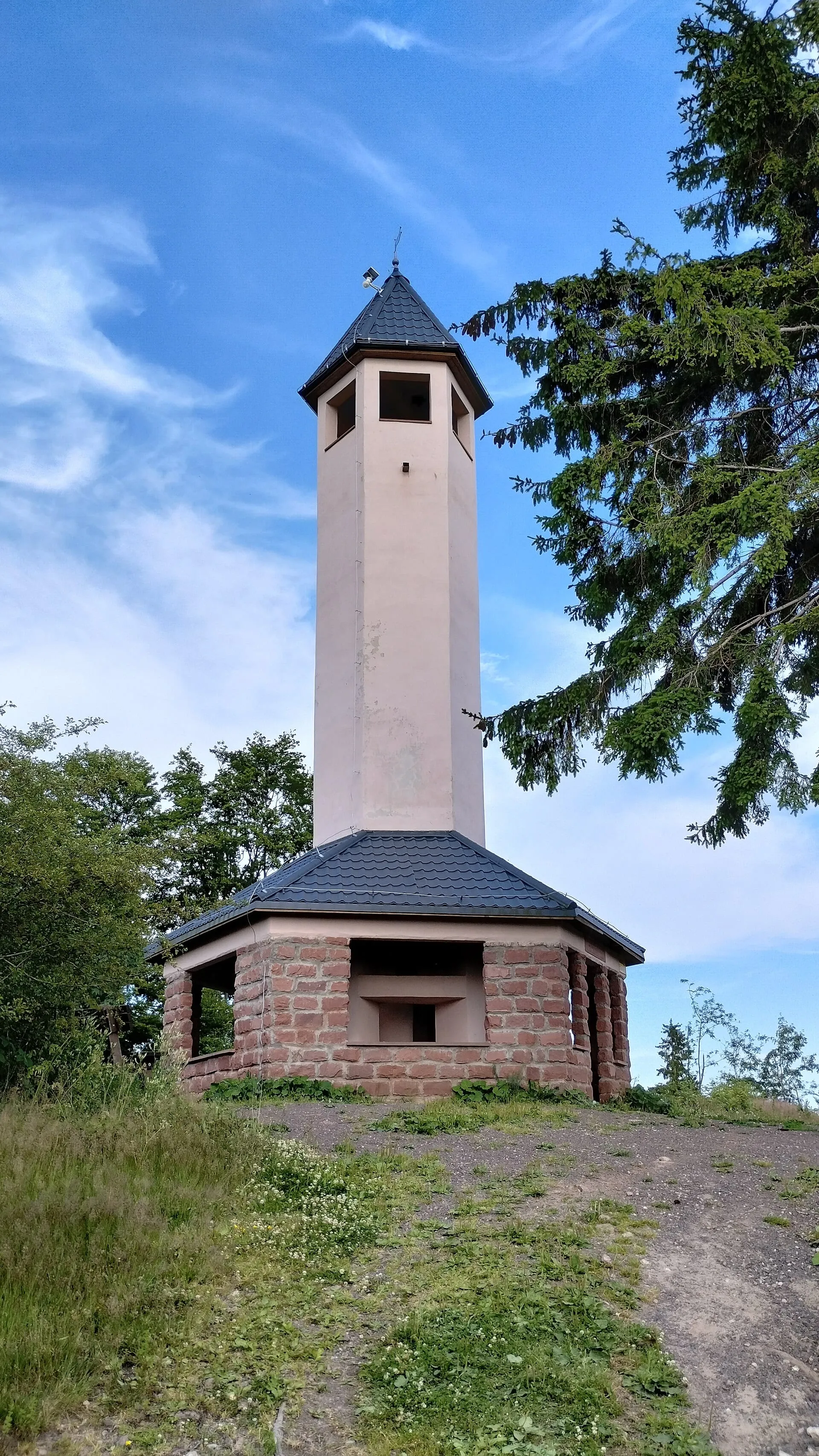
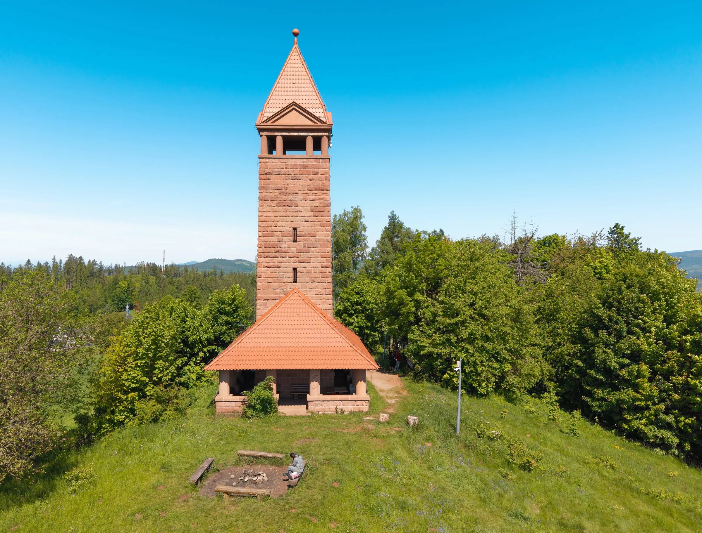
stone, 22 m, opened 5 August 1888; opens from spring to autumn in good weather, usually at weekends – check before you set off; the cross and summit are always accessible
Start
town hall in Boguszów-Gorce (581.58 m above sea level – according to the town, the highest-lying town hall in Poland); the green trail starts in the centre
Hike
green trail 3.3 km, 1 h 18 min uphill, 271 m of ascent; easy, the gentlest trail; back on the yellow trail 2.7 km, 6.2 km loop in 1 h 58 min
From the house
by car 13.9 km, about 20 min to the town hall; 10.2 km, about 18 min to the car park in Konradów; bus 2 to Boguszów-Gorce; on foot about 3 h via Szczawno-Zdrój
A Korona Gór Polski summit – partly thanks to a mistake: older surveys, taken from a point on the tower, gave 869 m, and with that figure Chełmiec made it onto the list; today it measures 850 m, which makes neighbouring Borowa (853 m) the higher of the two. Next to the tower stands the 45 m Millennium Cross, lit up at night. In the 1920s and 1930s cars raced up to the summit, and during the Cold War jammers here blocked Radio Free Europe: the first were housed in a building put up just after the war, and according to some sources another was switched on as late as 1981. The green trail from Boguszów-Gorce leads over Mały Chełmiec and the ‘Paluch’ rock platform.
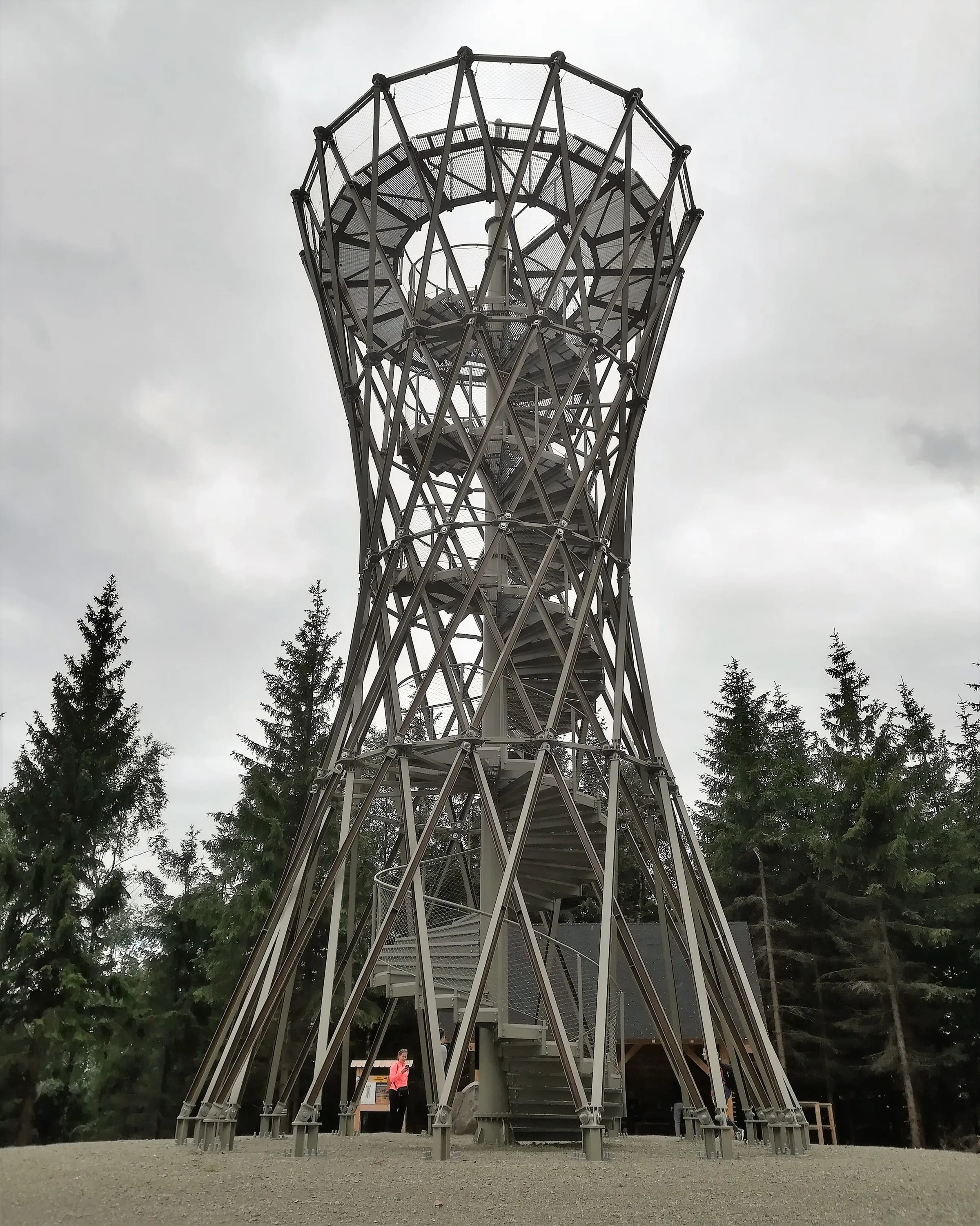
steel hyperboloid, 16.5 m, 90 spiral steps, opened 14 December 2017; free, open all year, day and night
Start
end of Pokrzywianka street in Kamieńsk (Jedlina-Zdrój), small free car park
Hike
2.5 km, 273 m of ascent, 1–1.5 h one way; first black, then red; the last stretch of the black trail (‘Ścieżka przez mękę’, the Path of Torment) is very steep – after rain take the red trail
From the house
by car 13.5 km, about 20 min; bus 5 to Kamieńsk
The highest point of the Góry Wałbrzyskie, but the summit itself is wooded and without the tower you would see nothing. From the top, though, you see Śnieżka, Wielka Sowa, Ślęża, Chełmiec and Trójgarb. The tower of 32 steel columns was designed by Zbigniew Mazij, and the Lower Silesian chamber of civil engineers named it the best project of 2017. The mountain has been called Borowa only since 1949 – before that it was the Schwarzer Berg (Black Mountain), hence Góry Czarne. If you have time, walk the red trail from Wałbrzych Główny station past the ruins of Nowy Dwór castle: 7.4 km, 486 m of ascent, about three hours.
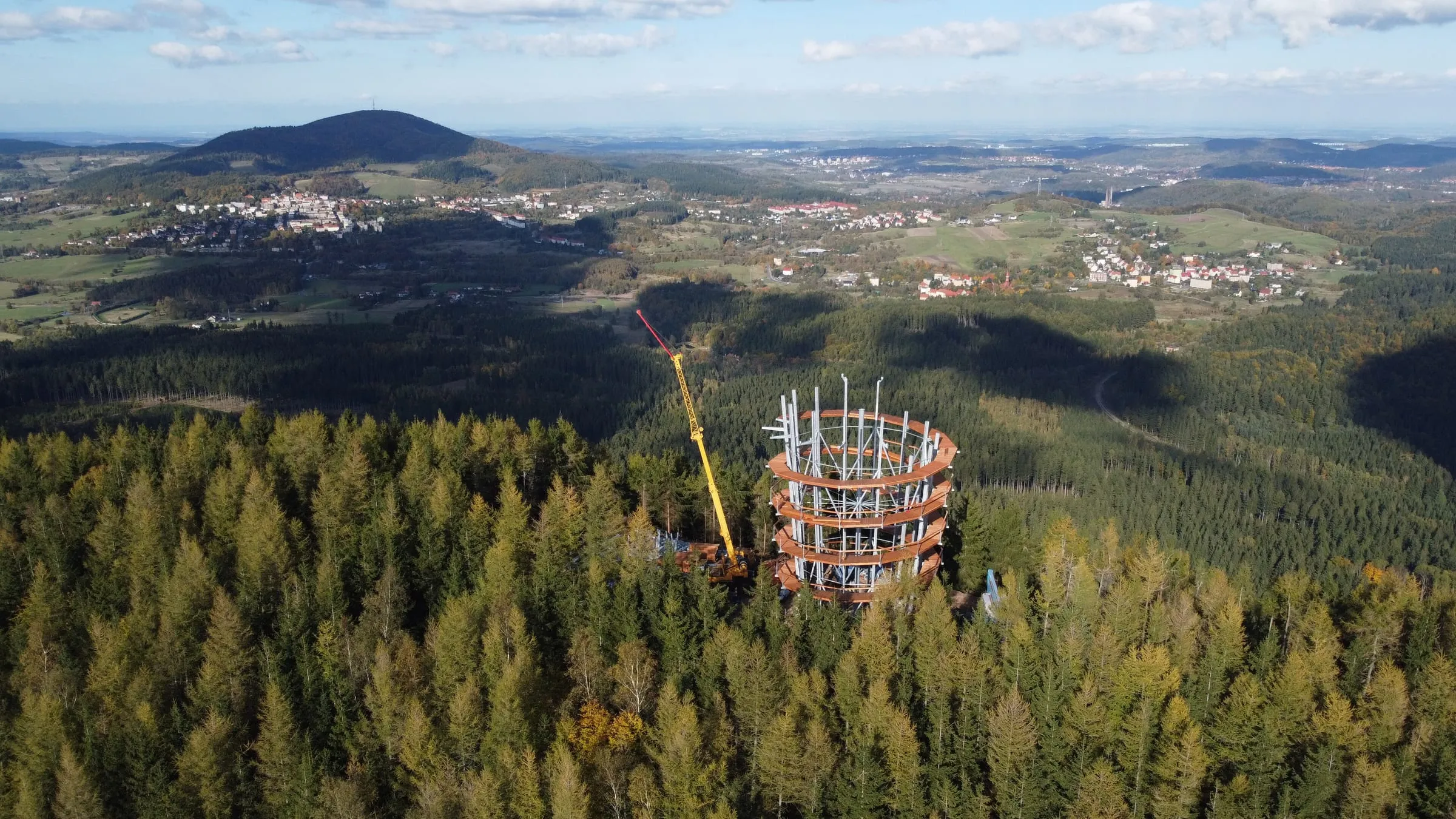
timber and steel, 38.5 m, platform at 32.5 m, spiral ramp with no steps, opened 15 February 2025; by the top station of the chairlift, about 500 m from the new tower, the older 20 m wooden tower of 2014; both free, open all year, day and night
Start
bottom station of the OSiR Dzikowiec chairlift in Boguszów-Gorce; two free car parks – at the station and about 500 m before it, full at weekends
Hike
yellow trail about 2 km, about 1 h, about 245–260 m of ascent; yellow/green loop 4.4 km; or by chairlift (weekends and public holidays) 10 min and about 500 m on foot
From the house
by car 15.3 km, about 25 min; bus 2 to the Dzikowiec stop, about 450 m from the bottom station
The tallest lookout tower in the area and the only one of the nine without a single step – the ramp spirals up to a platform 32.5 m above the forest. The chairlift takes up anyone who would rather not walk; a ticket for the ride down is sold at the machine by the top station, card only, no cash. The summit is a launch site for paragliders and the start of a downhill mountain-bike run. In winter the ramp can be icy.
concrete, 25 m, a former Bismarck tower, opened 24 May 1906, reopened after renovation on 16 July 2023; staffed, open at set times – daily from May to October, at weekends out of season, may be closed in bad weather; check before you set off
Start
car park at Przełęcz Sokola (754 m), by the Orzeł and Sowa mountain huts; paid car parks, a few free spaces by the road
Hike
red trail (Główny Szlak Sudecki, the Main Sudetes Trail) via the Orzeł and Sowa huts 2.8 km, 1 h 10 min uphill, about 260–300 m of ascent; easy, wide forest track
From the house
by car 27.6 km, about 37 min via Jedlina-Zdrój and Walim; bus 5 to Rzeczka (it does not go up to the pass)
The only summit above 1,000 m among the nine. The tower on top is one of the few Bismarck towers that still serve walkers today, and it even made it onto the coat of arms of Pieszyce – together with a fir tree and a golden mouflon. On a clear day you can see Śnieżka, Śnieżnik and even Wrocław's Sky Tower. The tower's balcony holds at most 15 people at once, children under 16 go up only with an adult, and animals are not allowed; on the summit meadow there are fire pits and shelters. At the foot of the mountain, in Pieszyce, the weavers' uprising broke out in June 1844 – the revolt that Gerhart Hauptmann, born in Szczawno-Zdrój, portrayed in his play ‘The Weavers’.
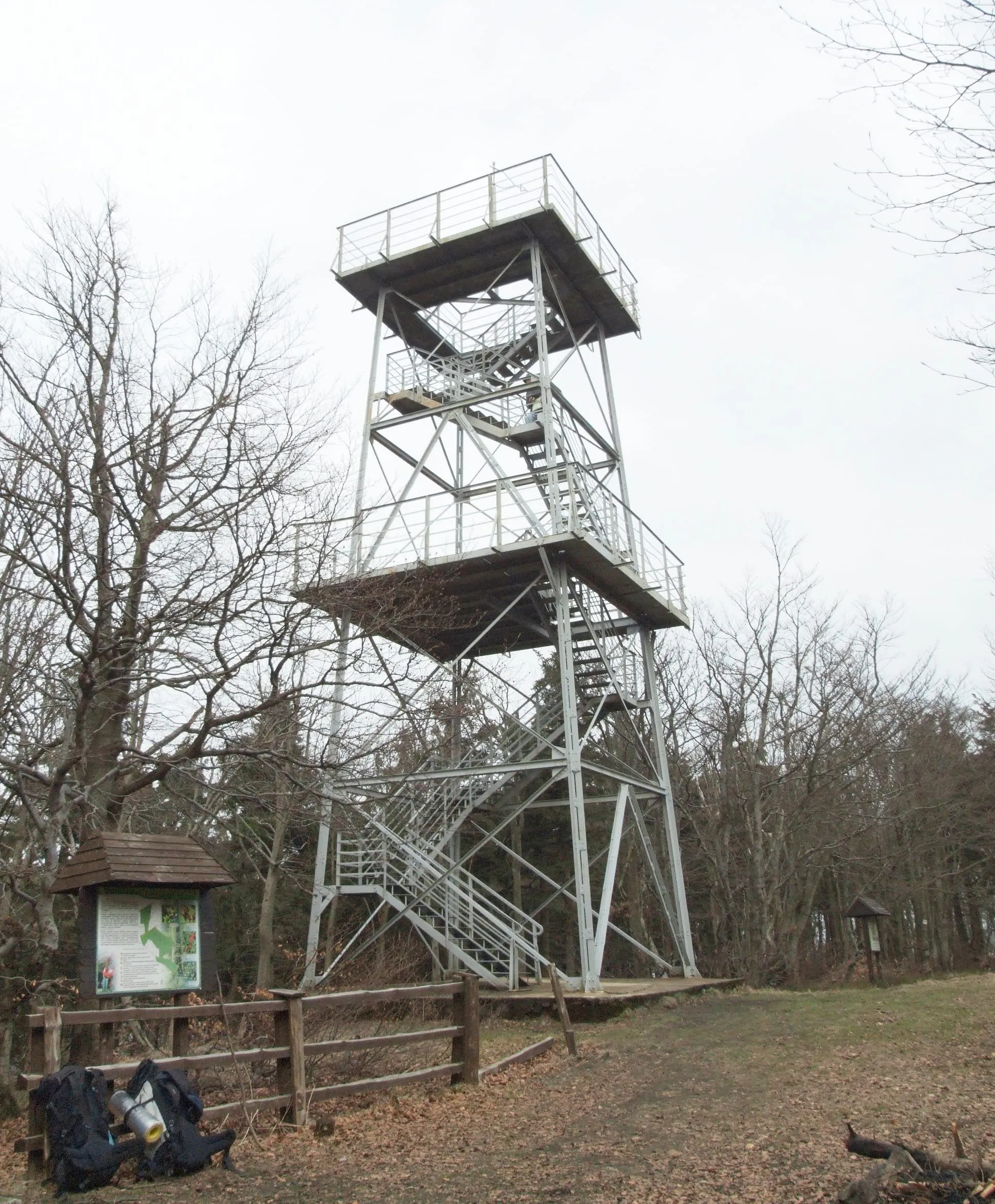
wrought-iron lattice resembling a pithead winding tower, 20 m, platforms at 14 and 20 m, 70 steps, opened 2 June 1933, renovated in 2022; free, open all year, day and night, unstaffed
Start
car park at Przełęcz Jugowska (about 800 m) by the Jugówka bar; small free car park at the junction, large paid one at the resort
Hike
black trail (shortest) 2.4 km, 54 min, 200 m of ascent; red trail via the Zygmuntówka hut 3.4 km, about 1 h 15 min, about 340–365 m of ascent; there and back about 2.5 h
From the house
by car 34.9 km, about 45 min via Głuszyca and Nowa Ruda
The third-highest summit of the Góry Sowie, in the Bukowa Kalenica reserve – the highest-lying beech forest in these mountains, with stunted beeches right below the top. The tower is never locked, and its upper platform, almost a thousand metres above sea level, is the highest of the viewpoints among the nine that are open at any hour. On a clear day you can see the Karkonosze (Giant Mountains) with Śnieżka and the Śnieżnik massif – a good spot for the sunset. The red trail takes you via the PTTK Zygmuntówka hut, built in 1926 as the Henkelbaude and one of the few pre-war mountain huts still in business; the black trail is shorter and has no stop on the way.
about 17 m, terrace at 15 m, 50 steps and a short ladder, at most 10 people; rebuilt in 2018 in a similar shape to the 1927 tower; free, open all year, day and night
Start
St Nicholas's church in Świerki, free car park by the church and the community hall; for those travelling by train, Świerki Dolne station, small free car park
Hike
red trail from the church 1.8 km, 45 min, about 200 m of ascent, there and back about 1.5 h; green trail from Świerki Dolne station about 2 km, 50 min, steeper; not for pushchairs
From the house
by car 29.9 km, about 39 min to the church; by train from Wałbrzych Główny to Świerki Dolne, several trains a day
One of the shortest and easiest climbs of all nine, and a summit you can reach comfortably without a car – by train from Wałbrzych Główny to Świerki Dolne. The first tower here, a square one of concrete and hollow blocks with a refreshment room at its foot, went up in 1927; the present tower was rebuilt in 2018 in a similar shape and size. Trees partly block the view, but you can see the Góry Sowie, Góry Wałbrzyskie and Góry Suche. Below the tower there is a roofed shelter with a fire pit. Some maps give 755 m.
red sandstone, viewing terrace at about 17 m, opened 29 October 1911, reopened after renovation on 5 October 2014; free, unstaffed
Start
market square (Rynek) in Nowa Ruda, the green trail starts at the railway station and passes the square; shortest from the free car park by St Anne's church, 450–500 m
Hike
green trail from the market square 2.1–2.4 km, about 1 h uphill, 246–277 m of ascent, there and back about 2 h; ‘Two Nowa Ruda Towers’ loop about 4.5 km, 2–3 h with children
From the house
by car 41.2 km, about 55 min to the market square; 43.4 km, about an hour to the car park by the church; by train from Wałbrzych Główny to Nowa Ruda about 41 min; the station is at the start of the trail
One of the first modernist lookout towers in the Sudetes, designed by the Berlin architect Heinrich Wolf and today a listed monument; from 1962, for more than half a century, it carried antennas and was closed to visitors. The green trail from the market square leads past the Pilgrims' Cross and three chapels built after the plague of 1680 to the Baroque St Anne's church with its Gothic statue of 1495; hermits once lived beside the church, at times as many as fifteen. The loop adds a second, 15 m tower of 1913 on Góra Wszystkich Świętych, which looks rather like a lighthouse.
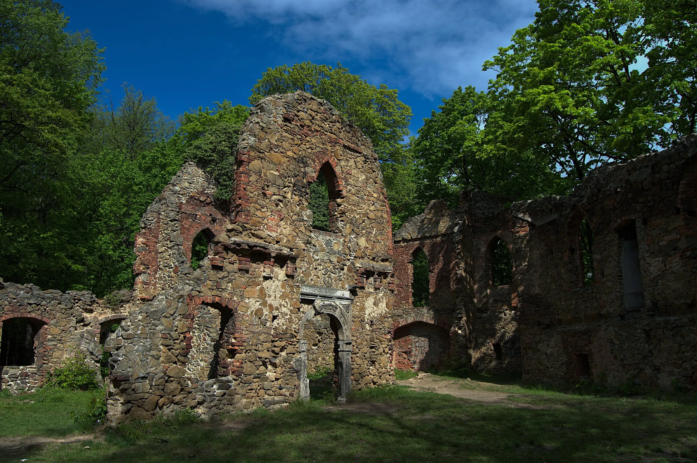
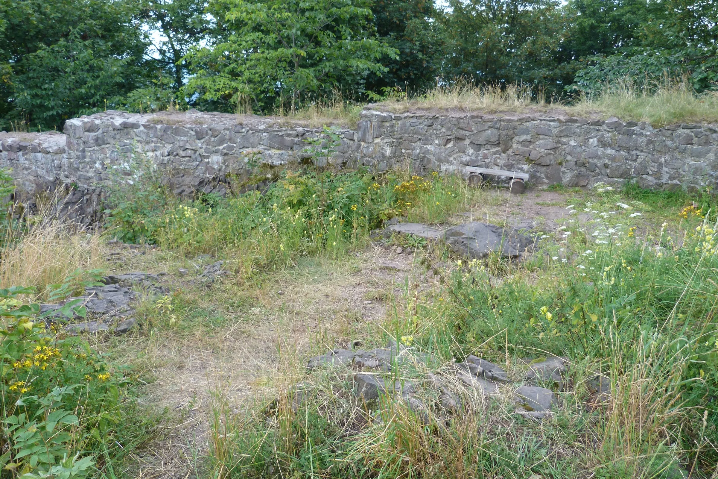
no tower – the ruins of Rogowiec castle, the highest-lying castle in Poland: first mentioned in 1292, captured and destroyed in the late 15th century; access free, round the clock, on foot only
Start
railway station in Głuszyca, the yellow trail starts at the station; shortest from the end of Wiejska street in Grzmiąca (leave the car at the junction at the end of the village); most scenic from the Andrzejówka mountain hut (car park by the hut)
Hike
yellow trail from Grzmiąca 2.5 km, 1 h 6 min, 305 m of ascent; from Głuszyca station 5.2 km, 1 h 53 min, 388 m of ascent; from Andrzejówka via the Skalna Brama rock gate 3.6 km, 1 h 16 min; the final stretch is steep and rocky, slippery after rain
From the house
by car 22.4 km, about 31 min to Głuszyca station; 23.7 km, about 33 min to Grzmiąca; by train from Wałbrzych Główny to Głuszyca; bus 5 to Głuszyca Górna
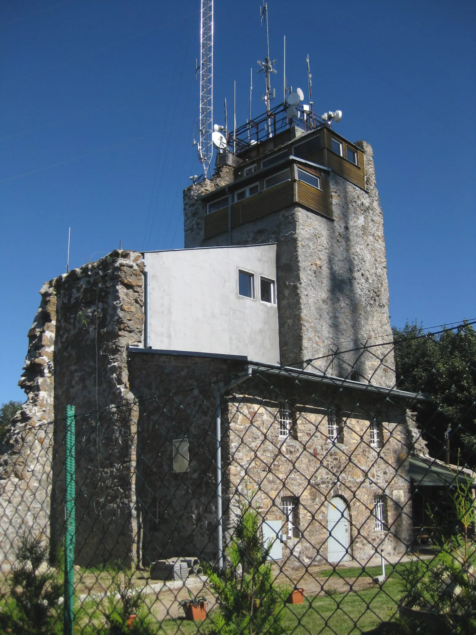
On the summit stand the ruins of Bolko I's border castle, which guarded the frontier with Bohemia. About 4 km away lie the ruins of Radosno castle – according to some historians, built by the Bohemians as a counterweight to Rogowiec. In the 15th century the castle's owners were accused of robbing merchants, and towards the end of that century it was taken and razed by the troops of Matthias Corvinus; archaeologists from the University of Wrocław have found fragments of cannonballs here. In the early 16th century the Hochbergs of Książ bought the ruin together with the surrounding estates. What survives are the curtain walls, remains of a bastion and a three-metre stump of the keep; there are two viewpoints – on the summit and lower down, by the white cross – and a fire pit. Only the yellow trail goes through the ruins; the red and blue trails skirt below them at the Skalna Brama.
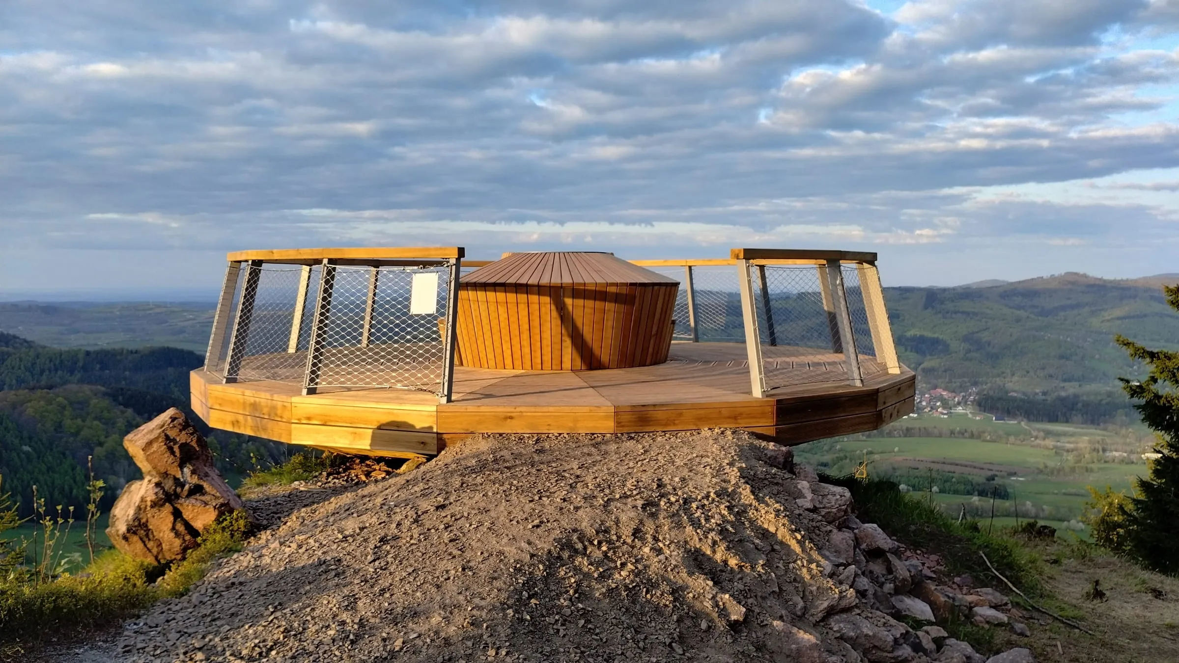
a platform instead of a tower – a round wooden deck on a steel base, with a bench and a panorama board, at about 790 m on the slope about 300 m beyond the summit, opened 27 April 2023; free, open all year, day and night
Start
railway station in Głuszyca, the green trail starts at the station; shortest from the end of Wiejska street in Grzmiąca (leave the car at the junction at the end of the village)
Hike
green trail from Grzmiąca 1.1–1.4 km, 33–40 min, 158 m of ascent, there and back about 1 h 10 min; from Głuszyca station 4.6 km, 1 h 42 min, 336 m of ascent; easy, through meadows and forest; loop with Rogowiec about 9 km
From the house
by car 22.4 km, about 31 min to Głuszyca station; 23.7 km, about 33 min to Grzmiąca; 20.3 km, about 30 min to Andrzejówka; train and bus as for Rogowiec
A 40-minute family outing: from Grzmiąca through meadows and forest to a wooden platform with a view of Jeleniec, the ruins and landslides of Rogowiec and the Góry Sowie. Some maps give 809 m. The unmarked Muflonowa Perć from Łomnica is a hard, rocky route – not for children.
Up Chełmiec on foot from the house
It is the only one of the nine summits you can genuinely reach from the front door. From the house along Fabiana, Wieniawskiego, Aleja Podwale and Słowackiego to the pump room in Szczawno-Zdrój is 4.4 km – roughly an hour on the flat. There you choose your trail. The black trail starts at the pump room and is gentle – fine even with a pushchair – but long: 10.3–10.5 km, about 3 h 25 min. It passes Dworzysko, a Hochberg estate farm from the mid-19th century that looks straight across to Chełmiec; the Swiss-style Dwór Idy there is now a café. The blue trail via Konradów is the shortest (4.6–4.9 km, about 1 h 50 min, 426–467 m of ascent – around three hours from the house in all), but the last kilometre is steep, with rocky steps. If the day is too short for Chełmiec, the tower on Wzgórze Gedymina, 5.8 km from the door, will do nicely: 30 m, a spiral ramp with no steps, free entry. The simplest way back is down the green trail to Boguszów-Gorce (3.3 km) and home by bus 2 or by train. If you would rather walk back, descend on the yellow trail via Biały Kamień: the full loop from the house is 20.5 km – 4 h 34 min of walking time, about 6 hours with breaks.
Góry Wałbrzyskie: three towers, half a day each
Chełmiec, Borowa and Dzikowiec Wielki are 20–25 minutes from the house by car, and each one makes a half-day outing. The gentlest way up Chełmiec is the green trail from the town hall in Boguszów-Gorce, past the fourteen granite stations of the Way of the Cross of Miners' Toil (Droga Krzyżowa Trudu Górniczego): 3.3 km and a little over an hour uphill, then back on the yellow trail for a 6.2 km loop. The stone tower on the summit opens from spring to autumn in good weather, usually at weekends; the cross and the summit itself are always accessible. Borowa is the highest point of the entire Góry Wałbrzyskie, but its top is wooded: for the view you need the steel tower, open all year, day and night, which you reach after 2.5 km and 273 m of climbing from the end of Pokrzywianka street in Kamieńsk. Dzikowiec formally belongs to the Góry Kamienne, but in practice it is the same kind of outing: about an hour on the yellow trail from the bottom station of the chairlift in Boguszów-Gorce, or 10 minutes on the chairlift at weekends and on public holidays. At the top stands the tallest lookout tower in the area, opened in 2025: 38.5 m, with a ramp and not a single step. For those who want everything at once: the yellow trail links Chełmiec with Dzikowiec, 17.2 km and 5 h 21 min.
Wielka Sowa, Kalenica and Wzgórza Włodzickie: a day out by car
Wielka Sowa is the only summit above 1,000 m in this set: from Przełęcz Sokola (27.6 km, about 37 min from the house) it is 2.8 km up the red trail past the Orzeł and Sowa mountain huts – a little over an hour on a wide forest track. The concrete tower is staffed and opens at set hours – daily from May to October, only at weekends out of season, and it may close in bad weather. Kalenica (34.9 km, about 45 min) is its opposite: an open wrought-iron lattice from 1933, unstaffed and open at any hour, 54 minutes up the black trail from Przełęcz Jugowska. Włodzicka Góra has one of the shortest routes of all nine – 1.8 km and 45 minutes from the church in Świerki. Without a car, take the train from Wałbrzych Główny to Świerki Dolne station, from where the green trail gets you up in 50 minutes. The ride itself is part of the outing: on the way the train runs through all three tunnels on the line to Kłodzko, including, just outside Wałbrzych, the 1,601-metre tunnel under Mały Wołowiec, one of the longest railway tunnels in Poland; beside it runs an older tunnel from 1876–1879, now disused. Above Nowa Ruda, on Góra św. Anny, stands a red sandstone tower of 1911, an hour's walk from the market square; the ‘Two Nowa Ruda Towers’ loop adds a second one, from 1913, on Góra Wszystkich Świętych.
Góry Suche: the Rogowiec ruins and the Gomólnik platform
Both walks start from the railway station in Głuszyca – 22.4 km, about 31 min by car, or come by train from Wałbrzych Główny: the yellow trail to Rogowiec and the green trail to Gomólnik begin right by the platform. On the summit of Rogowiec, a mountain of volcanic melaphyre, lie the highest-lying castle ruins in Poland (870 m), and the final stretch of the yellow trail is steep and rocky – from Grzmiąca 2.5 km and 305 m of ascent, from the station 5.2 km. Instead of a tower, Gomólnik Mały has a round wooden platform on its slope, opened in 2023, and one of the shortest climbs of all nine: from the end of Wiejska street in Grzmiąca 1.1–1.4 km and about 40 minutes – fine with children too; leave the car at the junction at the end of the village. The two are best combined as a loop of around 9 km, and anyone who prefers scenery to speed sets off from the Andrzejówka mountain hut (car park by the hut) via the Skalna Brama rock gate: 3.6 km to Rogowiec, a 7.9 km loop in 2.5 hours.
A sham ruin, a Bismarck tower and a tower hauled up by horse and cart
Three of these towers – on Chełmiec, Wielka Sowa and Góra św. Anny – have stood for more than a hundred years, and almost every one of them has a story of its own. The stone tower on Chełmiec opened on 5 August 1888: the Wałbrzych mountain society built it with money from the Hochbergs, the owners of Książ, modelled on a castle turret – it is a deliberately built ‘ruin’. On Wielka Sowa the first, wooden tower lasted only until 1904, when its stairs gave way. The concrete one, opened on 24 May 1906, was paid for by public subscription; on the ground floor there was a memorial hall with a bust of Bismarck, and an acetylene searchlight served as the ‘tower beacon’. Around 21,000 people climbed it in its very first year. The metalworker Kurt Steuer first assembled the Kalenica tower as a trial run in Bielawa, then took it apart and carted it up to the summit on horse-drawn wagons. The old names tell you when the towers went up: Bismarck Tower (1906), Moltke Tower above Nowa Ruda (1913), Hindenburg Tower on Kalenica (1933), and from 1934 the tower on Włodzicka Góra also bore Hindenburg's name. After 1945 the Wielka Sowa tower was officially named after General Sikorski, and in 1980 after Mieczysław Orłowicz; neither name ever caught on.
Before you set off, check at the source: the Szczawno-Zdrój municipality sets out the general rules for opening the Chełmiec tower, wielkasowa.eu lists opening times for the Wielka Sowa tower, and dzikowiec.info the chairlift times for Dzikowiec.